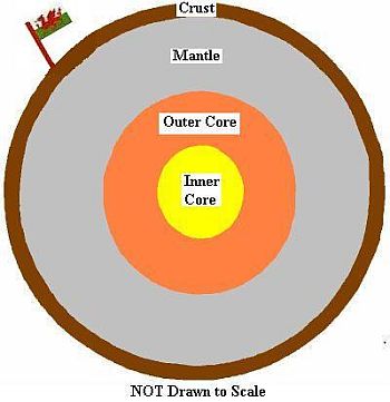
Some Captured History of Glanamman and GarnantA Geological Overview of CwmammanThe purpose of this page is to give a general summary of the geological structure of Cwmamman in a way which is easy for non-geologists to relate to. All figures given are approximate for the sake of simplicity. The Earth is made up of many layers of different rocks and minerals, surrounding a solid core which is believed to be approximately 1,500 miles (2,400 km) in diameter. The geological term for layer is "Strata". Each strata tells us something about events which occurred in that area millions of years ago. Some layers are made of igneous (volcanic) rock, others are made of sedimentary rocks, which were once at the surface before being covered by later layers. Taking average measurements of the Earth's radius, we can estimate that Cwmamman is approximately 3,950 miles (6,350 km) above the very centre of the earth. The core is mostly made of iron with much smaller amounts of nickel and perhaps other heavy elements such as gold etc. The inner core is solid because of the huge pressure, despite it's temperature being estimated as between 4,000 and 7,000 °C. The solid centre reaches outwards to a depth of somewhere around 3,200 miles (5,150 km) below Cwmamman. Covering the Inner Core is the Outer Core, which is again believed to be made mostly of iron, with some nickel and sulphur. The Outer Core however, is molten (in liquid form), although it is not quite as hot as the deeper Inner Core. It is the movement of the liquid iron in the Outer Core that gives us a permanent magnetic field around the planet. The Outer Core is approximately only 1,800 miles (2,900 km) beneath Cwmamman. Above the Outer Core is the Mantle, which makes up the greatest layer of the Earth and is approximately only 22 miles (35 km) beneath Cwmamman. It is the largest section by volume and stretches approximately 1,800 miles (2,900 km) from it's innermost to outermost parts. The Mantle is believed to be made mostly of rocks rich in oxygen and silicon as well as other elements such as iron and magnesium. The Mantle can be subdivided into upper and lower regions, which contain different kinds of rocks.
Surrounding the Mantle is the Earth's Crust, which is approximately 22 miles (35 km) deep at Cwmamman. The Crust consists of very large landmasses which geologists refer to as "tectonic plates". These plates float upon the solid Mantle. The reason we can use the word "float" is because the plates move very slowly. Cwmamman sits on the Eurasian Plate which moves at a rate of less than a third of an inch (¾ cm) per year and is the slowest moving of all the Earths major plates. All over the Earth, including Cwmamman, rocks have been pushed together by tectonic movement (movement of the Earth's plates), causing the rocks to fold and also to be pushed up to the surface. Where rock meets the surface, it is said to "Outcrop". In places, even very old rocks, which should be deep beneath the surface have been pushed up to the surface and there are several examples of these near to Cwmamman, especially on the nearby Black Mountains. Beneath the soil and clay are many layers of rock. Geologists use the term "Strata" when referring to a layer. Each layer can tell us a little about that location as it was when that layer was at the surface of the Earth, before being covered by newer layers and petrified (turned to stone) by pressure and heat. Cwmamman lies at the Northern boundary of the South Wales Coalfield, an oval shaped area which dips towards the centre from the outer edges. Knowledge of Cwmamman's geological makeup has been greatly helped by the surveys carried out by mining surveyors at various collieries, where snapshots of specific locations helped to build the bigger picture.
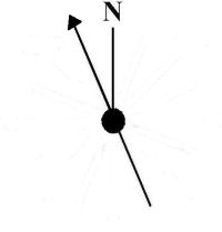
The rock layers beneath Cwmamman are tilted, and sometimes folded or pushed upwards or sideways by movements of the Earth's plates. In 1947, a geologist named Frederick Murray Trotter wrote an article which was published in the Geological Society's Quarterly Journal and some of the information from that article has been extracted, much simplified and abridged below. Earth movements which affected the geology of the Cwmamman area can be split into three episodes. The first episode occurred around 390 to 310 million years ago when collision between continents caused the mountains of Europe to be formed (including South Wales). During this time, forces from the South moved the strata Northwards causing tears to occur. These tear-faults are in a North-North-Westerly direction.
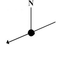
NNW Direction of Tear Faults The strata were pushed against what is known as the "Towy Anticline" (a fold in the strata which for simplicity can be thought of as bell shaped). This caused the newer rocks from the Paleozoic Period to form what is known as folds, thrusts and lag-faults in a West-South-Westerly direction.
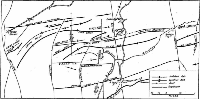
WSW Direction of Folds, Thrusts and Lag-Faults These fault structures form three natural groups in the general locality, the Cwmtwrch Compression Belt which reaches as far west as Gwaun Cae Gurwen and the Ammanford Compression Belt which first appears locally in the Millstone Grit on Tair Carn Uchaf and trends in an approximately West-South-Westerly direction (as above) towards Cross Hands and beyond. The width of both belts varies from one to three miles. The third group of fault structures is a simple fold in the Southern part of the area and is known as the Craig-Cefn-Parc Syncline. The Cwmtwrch and Ammanford compression belts lie in echelon (in a step like line).
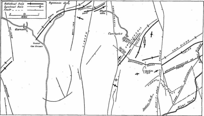
Cwmtwrch Compression Belt. Click on the image to enlarge. © Geological Society The second episode was a period of tension which caused a second system of North-North-Westerly faults to develop, which only raised or sank existing structures rather than moving them laterally. During the second episode, the whole of the area was tilted Southwards and the folds which were formed during the first episode developed a West-South-Westerly pitch. In the last episode, the structures of the first two episodes were moved laterally by the Northeasterly trending Tawe tear-fault. As Cwmamman sits within the Ammanford Compression Belt, it is this section which shall be described here. The Ammanford Compression Belt is divided into units by North-North-Westerly faults which cross it. Starting North of Cwmamman, the first unit of the Ammanford Compression Belt can be said to range from Tair Carn Uchaf, trending South-South-Westwards across the Tyllwyd and the Dau-dwfr faults as far as a major fault known as Gardeners Fault. The main folds in this unit are the Forge-Llandyfan Syncline and the Tair Carn Anticline.
SSW trend of Ammanford Compression Belt The crest of the Tair Carn Anticline is covered by an outcrop of Basal Grit which is broken only by an outcrop of Carboniferous Limestone to the east of the Tyllwyd Fault. The strata pitch towards the Southwest and end at the Gardners Fault. Ty-Llwyd Fault, stretches approximately from Carreg Cennen, through Cwmamman, extending to Banc Cwmhelen on the Betws Mountain. Gardners Fault, which is a tear fault, stretches from Llandyfan, through Cwmamman and extends as far as the Tawe Valley Fault. The next unit, relevant to the Cwmamman area, begins on the Western edge of Gardners Fault and extends as far as the Bettws Fault. Much of this area is covered in Glacial Drift. The major geological structures are not in line with those on the East side of Gardners Fault but cross the Bettws Fault without being displaced laterally by it.
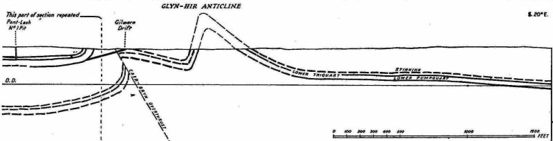
Ammanford Compression Belt. Click on the image to enlarge. © Geological Society Approximately West of the Forge-Llandyfan Syncline is the Caer Bryn Crushbelt which is around 200 yards wide. The crushbelt extends from Gardners fault, approximately a mile North-North East of Glynhir, to beyond the Bettws Fault without being laterally displaced. The Bettws Fault runs past the Llandybie area proceeding on near to College Street and the Square at Ammanford and follows on through the village of Betws and beyond. South of the Caer Bryn Crushbelt is the Glynhir Anticline which has an outcrop of Sandstone known as the Farewell Rock at Glynhir. South of the Glynhir Anticline, between the Pontamman and Gardner's Fault, although there is considerable displacement, the exact shape of the strata is not known.
Section of Glynhir Anticline. © Geological Society Cwmamman sits in a broad glacial valley, the last ice age ending around 11,500 years ago. By around 7,000 years ago, Wales in general had formed the shape which it is today and much of the Amman Valley area is covered with a thick layer of glacial drift. The valley is drained by the Westerly flowing River Amman and tributaries in the Cwmamman area include the Rivers' Garnant, Pedol, Berach and Grenig (sometimes spelt Garenig). When attempts were made to dam the river Pedol in 1925, the endeavor failed because after reaching a depth of 32 yards, no suitable foundation had been reached. The uplands of the area consist mainly of Pennant Sandstone. Regarding the Coal Measures at Cwmamman, a chart listing the workable coal seams is shown on a separate webpage. The seams are often separated by layers which are referred to as clift, clod, rashes and fireclay. Some of the coal seams have interesting features such as the Harnlo Vein which is characterised by a band of Cornish. The Peacock Vein is so called because of the colourful layer above it. The mudstone roof of the Peacock Vein contains solid stout Carbonicolae and Anthraconaia Modiolaris. The Brynlloi Vein lies within layers of strata described as the "Marine Band" and is charactarised by a layer of Anthracised Cannel (Cornish). The Little Brass Vein, also known as the Stinking Vein, contains plant remains in its sandy shale roof. The rooves of the Lower and Middle Veins contain Carbonicolae. The roof of the Bryn Vein consists of black shale and contains fish scales. At the base of Cwmamman's coal measures is a layer of silica rich red sandstone. Known as the Farewell Rock, it is over 300 million years old. Sandstone is a sedimentary rock and is formed by compressed sands. A Simple Picture of EventsSo what conclusions can we make about the history of the Cwmamman area from the geological and geographical information that we have. Firstly it is apparent that hundreds of millions of years ago, there was plant life and some simple animal life living in what was a swampy environment. Some inorganic sediments formed sandstones while later, organic remains formed coals and limestones. Moreover, Cwmamman has moved thousands of miles and is still moving as the Earth's plates drift across the Earth's mantle. The pressure of rocks squashing against other rocks has caused the rocks beneath us to buckle, warp and to slant with some of the oldest rocks pushed to the surface. Within the last twelve thousand years, the Amman Valley was carved by a glacier which carried rocks and soil with it as it moved through Cwmamman. As it melted, a deep layer of these deposits was left behind. Natural erosion is still taking place, with wind and rain slowly but surely wearing down the rocks which outcrop at the surface and the rivers carrying the tiny fragments away. It is interesting to note that although Cwmamman is not near the edge of a tectonic plate, that is, where earthquakes and volcanoes are prevalent, the area still undergoes minor tremors, most of which are completely unnoticed by the general public. One Tremor which was felt in the Amman Valley occurred on the 25th of August 1930, when candlesticks reputedly fell off the mantelpiece of one house in Ammanford and the Cricket Club's 5 a side game was disrupted when the bails fell off the wickets. The epicenter of the quake was at Skewen and the magnitude is believed to have been 3.2 on the Richter Scale. The event was reported in the Amman Valley Chronicle. The largest earthquake to be felt in Britain occurred on the 7th of June 1931 in the North Sea. It was felt throughout Northern Europe and it is claimed that it even produced a small Tsunani! The Wikipedia website states that it measured 6.1 on the Richter Scale, though the reported tsunami may have merely been a storm surge.
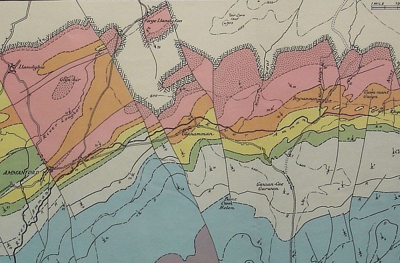
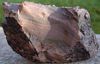
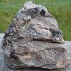
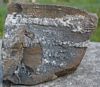
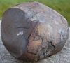
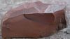
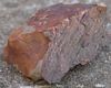
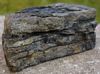
Structure Map of Cwmamman Area. Click on the image to enlarge and to view the wider area. © Geological Society Below are a sample of small rocks found on the site of the Gellyceidrim coal tip at Garnant. Click on the images to enlarge.
The Information and images regarding the geology
of the Amman Valley area were taken from an article titled "THE
STRUCTURE OF THE COAL MEASURES IN THE PONTARDAWE - AMMANFORD AREA,
SOUTH WALES", by Frederick Murray Trotter, which appeared in
the Quarterly Journal of the Geological Society Vol. ciii, part
2, 1947. Thanks go to the Geological Society for permission to use
the diagrams and information from the article. Please note that
copyright rules apply to all content on this page and any duplication
requires permission from the author and from the Geological Society.
|